Record of FHG meeting 21/10/2

Record of FULWOOD HISTORY GROUP MEETING 21st October 2024

Present: J.B., A.C., D.M., C.M., K.P.

Ringinglow Ramble Part II

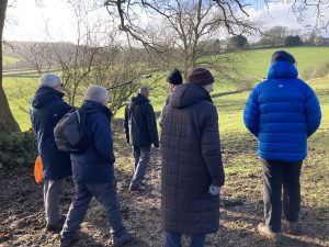
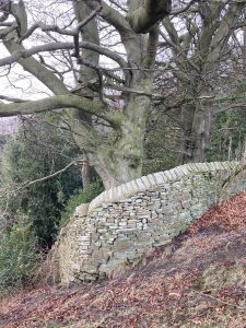
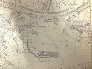
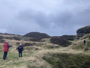
October’s meeting took the form of fieldwork around the Ringinglow area, building on our first Ringinglow walk in June. Our main focus was the mines and quarries of the area. Throughout our walk, DM referred us to the report From Cairns to Craters: Conservation Heritage Assessment of Burbage (Bevan, B. 2006. Moors for the Future) which contains information relating to features we looked at. See also Friends of the Porter Valley’s publication Mining and Quarrying in the Porter Valley – Delving into the Past (Peter Kennett, 2006) which provides details of most of the features we looked at.

  1. We met at the layby opposite the Norfolk Arms where we began by looking at AC’s copy of Burdett’s 1791 Map of Derbyshire
  2. We headed west towards Sheephill Road, passing the site of the old Weigh House and weigh bridge – see notes from June’s Ringinglow Ramble
  3. We took a short diversion over the stile on Sheephill Road and into Barberfield and the Limb Valley to revisit the site of former mines and remains of spoil heaps (see Bevan, 2006). We discussed the alignment of the Roman Road between Brough and Templeborough, how it may well have run across this area and recent archaeological work on this – a focus for a future walk.
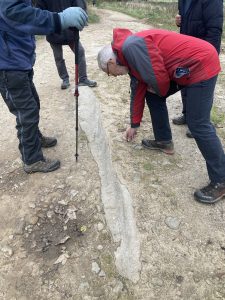
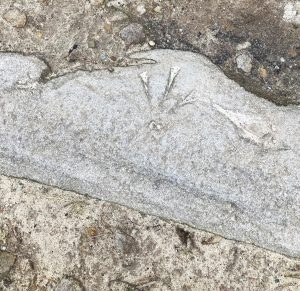
  4. After returning to Sheephill Road, we crossed over to the Houndkirk Road which leads to Stanage Pole. A couple of hundred metres along the track, (what3words) there are a number of embedded stones which appear to have a range of marks cut into them, one of which is a benchmark-type symbol. It was suggested that this could be connected with the military, who were active in this area during WWII.
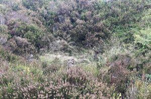
  5. After following the boundary of Lady Canning’s Plantation round to the northwest, we crossed Ringinglow Road and followed the track leading north to Brown Edge Quarries. Immediately to right of the footpath, we passed the sites of bell pits which were obscured by the heather and bracken. We heard about scars in the land left by peat workings and the remains of Kelly’s House, all of which lie to the west side of the footpath. For information on Kelly’s House, see AC’s December ’23 post on this website: Ringinglow People: Henry Kelly
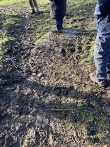
  6. Heading up to Brown Edge, we passed the site of a WWII bomb crater.
  7. We then dropped down over the edge and walked in a roughly westerly direction towards Brown Edge Quarries. On the way, AC pointed out possible boundary stones marking the former Derbyshire/Yorkshire border. See Alan’s Substack piece ‘Searching for Knaves’ to find out more.
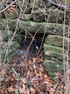
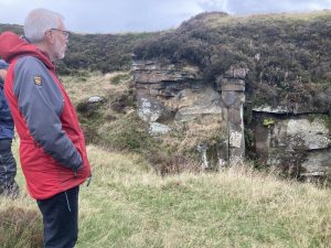
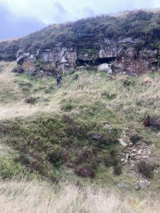
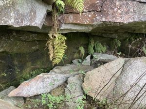
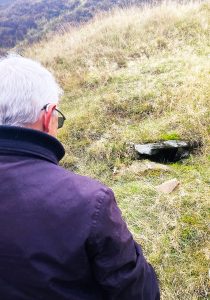
  8. We reached the Brown Edge quarry complex, ‘the most extensive in the [Porter Valley]’ (page 6, Kennett, 2006). It dates from at least 1715 and was still in use in the early twentieth century when Henry Hancock was the owner. The different types of stone extracted were suitable for various aspects of building such as walls, roof tiles, flagstones and paving stones. AC discovered what may have been a quarrymen’s shelter in the rock as well as an intriguing hole which seemed to have been built into the turf.
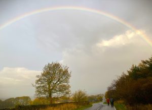
  9. A rainbow led our walk back to the layby along Ringinglow Road
  10. Next meeting November 21st at Broomhill Library


Record of FHG meeting 19/9/24

Record of FULWOOD HISTORY GROUP MEETING 19th September 2024

Present: D.A., J.B., A.C., M.G., M.L., S.L., D.M., C.M., K.P., J.P.

September’s meeting took place at Fulwood Church where we looked through the church’s archive. This included documents, photos, publications dating from the 19th century to recent times.

Takeaways from the evening:

  • Surprise at the range and extent of the material which gave an insight not only into the church, but also the history of Fulwood as a whole – and so the importance of preserving this archive (it’s to be deposited in Sheffield Archives)
  • The materials gave an insight into local attitudes, concerns and priorities e.g. the vicar’s report of 1880 and from 1919 there were descriptions of strikes at the end of the war
  • General consensus that the archive contains fascinating material and it would be good to look at it again in more detail.

Documents of note included:

  • The church accounts which indicated the connection which existed between Fulwood Church and Ranmoor St. John’s, in spite of tensions existing between the two:
    • Both vicars in the 1890s were Freemasons and on good terms
    • In the 1890s many donations to Fulwood were made from those who rented pew sittings at Ranmoor e.g. James Dixon and Frederick Thorpe Mappin
    • Both churches have windows donated by Freemasons containing Masonic symbols
    • Despite the different church traditions between them, they both seemed to have been supported by the same people to a significant extent
  • The recipe book of 1935 which contained not only interesting recipes but also two essays which define very clearly the evangelical nature of Fulwood worship
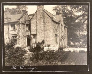
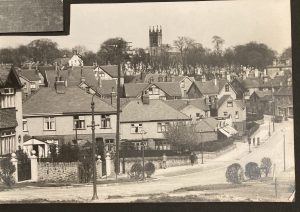
  • The photo albums which contained a number of interesting images: e.g. picture of the vicarage (where Newfield Court apartments stand), view down Brooklands Avenue towards Brookhouse Hill which predates the Co-op/photos of remembered schoolteachers
  • The record of the church’s missionary work in the 1960s/70s
  • The national (church) school log book
  • 1946 record of the contents Fulwood Road’s Guildhall when these were being donated to the church
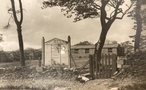
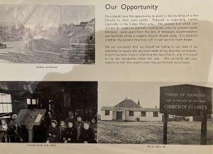
  • Documents relating to the 20th century development of St Luke’s on Blackbrook Road e.g. with use of a hut from Redmires Camp, the need for permanent premises as the suburb grew
  • Information relating to chapel at Ringinglow

Next meeting tbc


Heritage Open Days: Sports in Fulwood

Heritage Open Days 2024: Sporting Fulwood 14th September

Here’s a summary of FHG’s guided walk around sites associated with sports in Fulwood

  1. We began on Old Fulwood Road where AC provided historical background from Saxon and Medieval times to the twentieth century – see Alan Crutch’s article on our website: link here
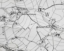
  2. Staying on Old Fulwood Road, we looked at how the former Blacksmith’s Arms/Hammer & Pincers, (now 4 Old Fulwood Road), played a significant role in local sport. Cricket and football teams were associated with the beer house and the Blacksmith’s Arms was a location for sporting activity too, probably on the field which lay behind the pub. 19th and early 20th century maps refer to this field as ‘School Green’ e.g. this one from 1894 (National Library of Scotland).From 1938, maps show the ‘new’, straight section of Fulwood Road running across this former sporting green. In the nineteenth century, teams in the main were made up of the local farming community. By the beginning of WWII, however, teams reflected how Fulwood had become a suburb, with members drawn from a wider area and from ‘white collar’ professions. The Health Authority Sports facilities, tennis courts and old sports hut are evidence of Old Fulwood Road’s 20th century sporting association.
  3. We also touched on Porter Valley sports such as swimmingand skating (see 1938 film footage Yorks. Film Archive) & Sheffield Independent 5th February 1912, boating – e.g. 1963 rescue . There was also model boat sailing on Wire Mill Dam which caused distress to local people. A Fulwood Society newsletter of 1972 stated that ‘the noise [made by the engines of the model boats] is so loud as to be heard more than half a mile away. We are not in favour of interfering with the way people spend their leisure hours but this excess noise is causing people who live nearby to feel ill and one family has had to move to another, quieter home’. The range of the noise these caused was confirmed by a group member. We drew on Chris Massey’s recollections of skiing, which took place further up the valley – see this link to Chris’ post on our website.
  4. We moved a little further west to the Scout Hut/Farmer’s Guild area to consider more widely how sports reflected social history and change and hear recollections of games played in the area around Fulwood Church and of the  former Brooklands Tennis Club. We heard how the history of sport in Fulwood and how it was enjoyed and organised reflects the changing nature of Fulwood itself. From a small community or communities of people in even more specific localities such as Goole Green or Stumperlowe, etc., 4 miles west of the town of Sheffield, Fulwood became an affluent residential suburb; and so the change from the less formal teams of local people, playing on the pub or church sports fields, to works teams organised by business owners who had moved into the area as Sheffield prospered and grew. These teams themselves probably comprised mainly of people living outside the community. Then the private members clubs developed, founded during subsequent waves of residential settlement. This has been a fairly rapid change, and probably some overlap between these different communities.
  5. We crossed over to the corner of Fulwood Road and Stumperlowe Lane where we learned about the extensive Rogers and Dixons works sports grounds which had stood on either side of Stumperlowe Lane and reflect on the role of large employers in supporting participation in sport for their workers.
  6. We walked past the Fulwood War Memorial and turned up to Chorley Road and Fulwood Sports Club where we heard about its history and buildings.
  7. The final location of our tour was Hallam Grange Sports Club, hearing of its connection with W.E. Harrisons, a renowned firm of steeplejacks founded in 1845 (and still running now). In 1923 they set up a tennis club at the top of Slayleigh Lane, with the clear intent of it being usable by the local community as well as employees of the company. Table tennis was also played. Perhaps unusual at the time women and families were equally welcomed to play, and to join the organising committee. By the 1960s the facilities were getting tired, and the Harrisons sold further land to enable the club to move to its current site further down Slayleigh Lane. This also gave space for bowls. The club had/has an excellent crown green lawn, despite the difficulties of a high and exposed site. Visitors on the walk discussed how the development of this club reflected changes in society during the first part of the 20th Century, illustrated by the club’s continuing balance of social and competitive sports.


Early Sport and Entertainment in Fulwood (and a few more modern children’s games)

Here is Alan Crutch’s piece giving background and context to sport in Fulwood: from Anglo-Saxon period through to the twentieth century. 

The earliest organized sporting activity in this area was, almost certainly,  hunting. Fulwood was covered in forest and it is likely that the Hall which the Saxon Lord Waltheof owned was what we would identify as a hunting lodge. In the Norman era, Fulwood was part of Rivelin Chase, a large area, set aside for hunting. There was even what we would call a game warden whose job it was to try and prevent the second earliest local sport, namely poaching.

Stopping ordinary people enjoying themselves through sport seems to have been something of an obsession throughout the Middle Ages. Football was certainly a banned activity as it took young men away from what was their civic duty, – archery practice. Back then it was all able-bodied men’s obligation to turn up to hone their skill with the bow. At any time they might be required to go to war as part of the Lord of the Manor’s obligation to provide a certain number of armed men when required by the monarch. In Fulwood they practiced on the May Field. That was the field near the bridge over the stream that supplied the mill built by Ulysses Fox in the 1600’s and which is now the animal sanctuary. The old name for the bridge is Butts Bridge.

The earliest name I have found for a Fulwood man being involved in ‘sporting’ activity is that of John Lynnot. The date was 1441 and he was fined one shilling for playing at rounds and dice and panning. I have no idea what rounds and panning may have been but they were certainly illegal. It seems as though he may have been keeping dubious company because, at the same court, a Robert Le Carre was fined a Mark (a third of a pound) for drawing blood from the same John Lynnot. The Lynnot family probably came over with William the Conqueror and were a well-established Fulwood family holding land in the area of Fullwood Hall and possibly responsible for the original construction of the Hall.

By the time of the Tudors, bowls was a popular game. In Fulwood there was an area off what is now Redmires Road. In his 1637 survey of this area. Harrison describes part of the area now used for the golf course as “Bowling Allie”. Ironically, the area next to it was called Hell Hole and another area is described as “Rough Close”. These are shown on the extract of Scurfield’s plan to the 1637 Harrison survey, all next to Barren Cliffe Highway (now called Redmires Road)

Football still had a bad reputation in the early 1600’s. In King Lear, Shakespeare compares one of the characters to “a base football player ”, and in 1608, a Manchester resident complained

“With the ffotebale … [there] hath beene greate disorder in our towne of Manchester we are told, and glasse windowes broken yearlye and spoyled by a companie of lewd and disordered persons “.

They are like that in Manchester though and I’m sure that Sheffield provided much better players of the game. Notwithstanding this, football, along with all other forms of enjoyment, suffered under the Commonwealth of the 1650’s when the punishment for being caught playing the game was to be put in the stocks (presumably not all at the same time). The stocks in Fulwood were on Brookhouse Green, which was a large Common which included the land on which the Co-op now stands.

Those in the stocks were there for public humiliation, Other forms of punishment were also popular spectator sports. The pillory and the cuckstool (for scolding women) had their own attractions, but far more popular was the gallows. There is a rumour that one existed in the Bennet Grange area, but I have seen no real evidence for this, although there are several reports of hauntings on Harrison Lane near the water troughs.

The market in Sheffield also provided entertainment from time to time. As late as 1822, a hatter auctioned his wife, The winning bidder paid 5 shillings, a silver watch, and a gold chain. R E Leader reports that the original Chronicler reported “The lady it seems was nothing loathe to the transaction.” .

Moving on to more traditional sports and forms of entertainment, these days they often take place on Sunday but in 1732 there was no pie and a pint after a game. This was the message that was sent out to every parish in the land.

“…. The Lords Day is often prophaned in your parish by disorderly Meetings of several idle persons and by Gaming, Sports and Tipling in Publick Houses and Shops and by Persons using their Trades and Callings on that Day contrary to the Laws in that Case made and provided which disorderly and unlawful proceedings, tend to the Encouragement of Vice, Lewdness and Immorality, to the great dishonour of GOD, Disturbance of the Inhabitants, and evil Example to others.”

Despite restrictions like the above, the Commons and Village Greens in Fulwood were areas used for recreation, Some of the games played there would have been familiar to us. Skittles, Quoits, Knurr and Spell and Penny Prick were all played. Penny Prick was a game where oblong pieces of iron were thrown at a mark some distance away.

I had heard of Knurr and Spell but did not know much about it until I did some research. It seems to have been very popular in Yorkshire and originated on the Yorkshire Moors. The Knurr was a small round ball of wood or porcelain about the size of a walnut and the Spell was a lever that released the Knurr into the air where it would be hit with a four-foot long wooden stick often made of ash to which was attached a six inch long by four inch wide  pommel made of very hard wood.  The Knurr might travel up to 200 yards once struck. Not a bad drive even by today’s standards.

Less acceptable today were the bull baiting, dog fighting, cock fighting and bare-knuckle prize fights that took place.  The nearest evidence of cock fighting taking place in the Fulwood region is again given by Harrison in his 1637 survey. On the map prepared by Scurfield, the area we now know as Ranmoor was described as Cockpitt Green! As Leader observed in 1901,

As villages and towns and counties now compete with one another at cricket and football, so in those days the championship they aspired to was to breed cocks that could kill those of the rival community.”

Below shows Cockpitt Green to the far right of the extract. I wonder how popular it would be if Ranmoor was to revert to its old name? As can be seen, Fulwood Road did not exist in 1637.


Similar to cock-fighting, there was one other activity that the authorities were concerned about – Throwing at Cocks. This was a barbaric practice which involved object being thrown at a live cockerel with the sole intention of injuring and eventually killing the bird. It was decided that the public should be encouraged to enjoy more wholesome entertainment, and so the Sheffield Town Trustees attempted to divert the population away from that spectacle in 1757 by paying cricket players 14s 6d to play a match in Sheffield on Shrove Tuesday to “entertain the populace and prevent the infamous practice”. So by the 1750’s the authorities were beginning to change their attitude to organized sport.

Then there was horseracing. This plan shows the famous one superimposed on a modern map

Horseracing was popular with all classes. The course existed between 1713 and 1785 but was swept away by enclosure (its removal was partly responsible for a subsequent riot in Sheffield). Lesser known was our own Fulwood Racecourse, technically at Redmires, but we are still claiming it as ours. Keith Baker’s book Redmires Tales from the Ridge tells the story that, in the 1870’s a group mostly comprising local publicans decided that horse-racing needed to return to Sheffield. Redmires was the chosen site, no doubt much to the pleasure of the landlords of the Three Merry Lads and the Sportsman Inns which were immediately next to the course, a one-hundred-acre site situated between Redmires Road and Brown Hills Lane which was one of the few places in the Sheffield area that was reasonably flat! I am told that for two years prior to completion of the project, greyhound racing took place on the site.

Opening day was Monday 30th August 1875 and the Redmires Road was thronged with people and carriages hours before the first race which was scheduled to start at 14.30. Commenting on how full the local ale houses were on that day, a local reporter wrote

“It was a question for wonderment that so many people should be so thirsty at the same time, and that so many others have the overpowering idea of the value of getting drunk before the racing began ……”

To get into the course the drinkers and all others would have had to pay sixpence. Entry to the grandstand cost five shillings. There were five races and various forms of entertainment. The meeting was well attended and a financial success. The following day the meeting was less well attended, presumably because most of the would-be spectators had lost what money they had on the previous day! There was only ever one further meeting before the whole enterprise failed. A few high walls that use to surround the course can still be found, but Fulwood’s Ascot is now long gone.

More recently (1973) Charles Marsden recorded his memories of children’s games in Fulwood. These are his recorded words

We used to play at different games that they don’t know nowt about now. Peggy for one thing.

We get a broom shaft, saw it about that length [ten inches] and sharpen it at both ends. Then ‘ave a part of broomshaft to tap it with you. You used to tap it then strike at it or otherwise tap it and double with it, hit twice. You had to stride, give ’em how many you thought they could do it in. If you thought they could do it in twelve you might — we used to start off at Greenfall Gate here — you’d gi’ ’em ten, well they had to try but they couldn’t do it. That counted to you. That’s ten to you.

Then we used to play at Kickcan a lot, Whip we called it. We had old can, top of yard yonder ••• See who were goin’ to be on, you know, who were last out. Him that were on were to kick ‘is can as far as he could and he’d to go for it, and while he were going for it, we were playing Hidey. If he went far away from can to seek us out, somebody come out from somewhere else and kicked it again. Then he had to find you all .

Soon as we got out of school, ‘Stop in last un at Blackthorn’ , that were a decent job. Used to have a mark across road down by’t school ‘ere and as far as Greenfall Gate. ‘Im ‘at were last in ‘ad to be in for a start. ‘E’d to be in t’middle between lines like, well, they could try to get past him. They’d be one goin’ past one way and one goin’ past other. Most of ’em ‘ad got their jacket sleeves torn off. When you caught one he’d to stop in and help you.

We played at Rusty a lot you know. One stood at wall for your pillow and if there were three on you playing three more, three on you got down, got with your head down on to ‘im and t.’other got ‘old of your jacket back. These other three used to have to jump on you and used to land on back of you, no scrawming, you used to be trying to scrawm up. But if one fell off you see they lost. ~’hoy’ d to got down. You had to. hold ’em while you gave in like. I know I were very of ton first to jump and I’d only one good leg but I could ‘op .;I. ~ong way. I could ‘op onto third man many a time, plenty of room for other two to come. It were Rusty an’ all one lad got’s leg broke wi’t at side of Royal.

We’d talk about playing In and In, same as Kickcan nearly. You’d to be in den, side of gate an’ they’d to go out and get Hidey like and you’d to go and find them. We used to go round top of street, there were some old places, a blacksmith’s shop and two or three more places you could go. It’s a long way downt’ Street and I’ve had my knees peeled many a time. Used to be a rum road. Daren’t go and find you.

Then we had sometimes, ‘it were like a hunt. They used to go right round Hill Top, all the way round. You had to go after them like hare hunting. Hare an’ Hounds, no trail. You had to shout, ‘Give a Tally O~’ so they’d ‘Hoo-hoo~’. You had an idea which way they was. They happen weren’t there when you got there, you know.

Recorded 12 July 1973.


Record of FHG meeting 15/8/24

Record of FULWOOD HISTORY GROUP MEETING 15th August 2024

Present: D.A., J.B., A.C., M.L., K.P.

August’s meeting was to take the form of a walk-through of the Heritage Open Days tour but due to the wet and chilly weather, it took place under cover at the Rising Sun.

We produced a plan for this year’s guided walk – Sporting Fulwood (14th September):

  1. Old Fulwood Road:
    1. AC historical background
    2. 4/Blacksmith’s Arms/Hammer & Pincers – bowling green?, location for sporting competitions – pigeon shooting and venue for Hallamshire Hunt annual dinner in April 1863
    3. Before construction of ‘new’ section of Fulwood Road – field behind pub used for sports
    4. 1854 ‘capital cricket club’
    5. 1860 Hallam FC
    6. Willow Football Club 1886
    7. Porter Valley sports at Forge Dam, Wire Mill Dam, Jacob’s Ladder: boating – e.g. 1963 rescue Neville Haigh & Dick Hill (DM), model boats (F. Soc newsletters), swimming. skating (see 1938 film footage Yorks. Film Archive) & Sheffield Independent 5th February 1912 .  skiing (Yorks Film Archive footage from 1938 & F. Soc newsletters from 1970s/80s and C.M. recollections)
    8. Health Authority Sports facilities, tennis courts, old hut
  1. Move onto Fulwood Road, near to Guild Hall for view across road of site of former sports fields:
    1. Works grounds: Joseph Rogers (cricket ground), Cornish Works, Dixons 1920s, DA’s recollection re great grandmother’s brothers playing cricket at Round Stubbin – could have been within current churchyard? DM’s aunt – hockey
    2. Transport provided by firms
    3. Motivation for this – avoid Communism, drink and preparation for war
    4. FC&SSCC: Fulwood Church & Sunday School Cricket Club
    5. Key roles of church and pubs in supporting participation in sports
    6. Brooklands Avenue tennis club
  1. Cross road to verge at bottom of Stumperlowe Hall Road to walk between two former sports grounds and note former Bowling Green House

Google Maps 2024

  1. Turn left into Slayleigh Lane and to Fulwood Sports Club
  2. Walk up to Hallam Grange Lawn Tennis Club: ML
  3. Review – incl. social/political aspects:
  4. Changes over time: reflecting changes in demographic/population as Fulwood moved from rural community into suburban – inclusivity/exclusivity
  5. Handouts? Maps? Laminated images to show/share?
  6. Next meeting 19th September: meet at Broomhill Library for debrief and plan ahead – walks, meetings, projects and events


Fulwood Skiing

During years when there was adequate snow, Jacob’s ladder, South of the Porter Brook, was a very attractive skiing slope and probably the best in Sheffield. I became a member of The Hallamshire Ski Club, which was formed in 1969, and enjoyed several years in the mid’ 1980s before lack of snow became the norm.

There was a surge in development of equipment which was a great boost for the sport; lace up leather boots, wooden skis and cable bindings were superseded with modern plastics and clip bindings.

Portable tows such as the Bimbo or Britton, that fitted into a car boot, provided a practical advantage, compared to modifying a car or tractor engine that involved considerable work and expense.

To set up the tow, a pulley was anchored to a tree at the bottom of the slope, the rope went round the pulley and back up to the engine. It was possible to hold on with gloved hands, but someone made a clever alloy hook that saved destroying your gloves. It was essential to disengage before the cut-off point. Several runs were needed to create a reasonable piste and remove stones.

I remember one year when there were three tows – the Hallamshire Club, Sheffield University and a club from Doncaster, plus the tobogganers, often out of control. With good snow and glorious sunshine for several weeks, the Norfolk Arms Ringinglow became quite Continental with Glühwein flowing. Eventually the snow became thin, and in the end, it was more frozen grass, but we adapted!

The Hallamshire built a hut at the top, on the East side, to permanently house the tow, but lack of snow and probably onerous health & safety requirements, resulted in it being dismantled in 2008. However, the club is still active, finding snow elsewhere.

Chris Massey – 3rd February 2024

Record of FHG meeting 20/6/24


Record of meeting 20th June 2024

Present: J.B., A.C., M.L., D.M.

Ringinglow Ramble Part I

For this summer solstice evening’s meeting we explored aspects of Ringinglow. AC has written four pieces about Ringinglow which are available on the FHG website – see reference list at end of these notes. The area has been known/recorded as ‘Ringin Lowe, Ringing Lawe’ and ‘Ringinglowe’, (see Harvey, 2001 for etymology and Crutch, 2023 for ancient historical background). Until around the early 20th century, this was an industrial as well as farming area. It included quarries, mines, a wire mill and Copperas House.

1855 (click on image for link to map) Reproduced with the permission of the National Library of Scotland https://maps.nls.uk/

1898 Reproduced with the permission of the National Library of Scotland https://maps.nls.uk/

1924 (click on image for link to map) Reproduced with the permission of the National Library of Scotland  https://maps.nls.uk/

1947 (click on image for link to map) Reproduced with the permission of the National Library of Scotland https://maps.nls.uk/→

  1. We met at the layby opposite the Norfolk Arms; tractors were passing frequently between Sheephill Road and Hangram Lane as they transported hay – a process which had been going on from early that morning. Go back a hundred or so years and this would have been a similar scene on a dry June evening, but with horses pulling the hay wagons: Hall, 1974 contains photos of early twentieth century haymaking at Bole Hill Farm land and Brown Hills Field
  2. We looked for evidence (e.g. boundary walls, types of vegetation) of the Weigh House which used to stand at this corner (Crutch 2023)
  3. We also considered the evidence of mining and source of the Limb Brook in Lady Canning’s Plantation and the ‘Ring of Firs’ a little further west from the Ringinglow cross roads (see Hall 1974 and Crutch 2023)

Firs and bulge in wall 1855 and present

           Google Maps

1855 map reproduced with the permission of the National Library of Scotland https://maps.nls.uk/

4. We then walked round the corner onto Sheephill Road and crossed the stile into Barberfields to look at evidence of coal mining, the remains of Copperas House and other features: DM pointed out the spoil heap and referred us to FoPV report August 2006; AC shared maps and information; there are remains rail tracks but we didn’t explore that far

We discussed roads and tracks in the area:

  1. important links between Derbyshire, Cheshire, Manchester and Sheffield
  2. transportation of goods such as lead (Smeltings Farm nearby)
  3. the evidence of Roman roads, the Houndkirk Road, Ringinglow as a turnpike road, how roads developed and became more or less significant (see Hall & Blackwell, 1972 pp 20-21 and Crutch 2023)

5. We retraced our steps over the stile and considered the buildings edging Sheephill Road

    1. Moor Cottage – formerly Moorcot/Moorcott- which was built on the site of Moorcock Hall in 1911, according to Hall, 1974, p. 38
    2. The Mission – formerly Ringinglow Church (Crutch 2023 and pages 39-40 of Hall 1974)
    3. The Round House (Crutch 2023 and Hall & Blackwell 1972, pp 20-21)
    4. The ‘low’ suffix of Ringinglow indicates a large pile of stones which could have been a barrow (Harvey, 2001); Crutch, (2023), suggests a site for these stones could lie somewhere between the present day Moor Cottage and The Norfolk Arms


6. We crossed Ringinglow Road and looked at evidence of the former wire mill; a resident of the cottage kindly showed us the outbuildings where the milling took place (see Crutch 2023)

We noticed the signs carved into the kerbstones on the corner of Ringinglow Road and Fulwood

7. Walking east past the Norfolk Arms, there is a Victorian wall letter box and by the car park exit there is the milestone CITY OF SHEFFIELD 5 MILES TO TOWN HALL; the reference to city dates the stone as post 1893; perhaps it replaced an earlier milestone which stood here when Ringinglow Road was a turnpike (1758 – 1825)

8. Next meeting/walk 18th July – meet at Ringinglow layby 7pm for Ringinglow Ramble Part II

References

Crutch, A. (2023) Four Posts Giving a brief history of Ringinglow. Fulwood History Group. https://www.fulwoodhistory.uk/author/alan/

Friends of the Porter Valley. (2006). Mining and Quarrying in the Porter Valley – Delving Into the Past. Friends of the Porter Valley. https://www.fopv.org.uk/product-page/mining-and-quarrying-in-the-porter-valley-delving-into-the-past

Hall, M. and Blackwell, R. (1972). The Mayfield Valley. Mail Graphic

Hall, M. (1974). More of the Mayfield Valley with Old Fulwood. J. W. Northend Ltd

Harvey, P. (2001).  Street Names of Sheffield; The stories behind Sheffield’s street names. Sheaf Publishing.


Record of FHG Meeting 16/5/24

Record of Fulwood History Group Meeting 16/5/24

Present: J.B., A.C., R.F., M.G., M.L., C.M., D.M., J.P. & K. P. + 1

A Ranmoor Ramble : for this meeting we strayed off Fulwood territory

Link to 1906 map of area

We met at Ranmoor St John’s and heard about MG’s Scissors Paper Stone project

We then walked north up Ranmoor Park Road which included:

  • site of Ballard Hall: named after Alderman Ballard: Chairman, National Co-operative Party; member of Sheffield City Council; Chairman, United Sheffield Hospitals, Board of Governors
  • Ranmoor Parish Centre – Ranfall – in late 40s was Ranfall Nurses’ Home
  • Impressive house at 16 Tapton Park Road
  • Triangular green
  • Where Ranmoor Park Road ends at ‘The Rigi’, which forms a cul-de-sac; discussed reasons for its name, its boundary wall

Left down Ranmoor Crescent which included DM’s explanation of inscriptions seen on telegraph poles

Onto Ranmoor Road – including discussion of remarkable drain covers

Ramble concluded at Ranmoor Inn.

N.B. Graham Hague’s piece from The Star 29/12/20 covers some similar ground

Next meeting/walk 20th June – details tbc

Record of FHG Meeting 18/4/24

Record of Fulwood History Group meeting 18th April 2024

Present: D.A., J.B., A.C., M.L., C.M., D.M., J.P. & K. P.

  • Discussion around Fulwood Society documents over period 1970s-90s which are being looked through by group members: newsletters, letters, photos, press cuttings etc. E.g.
    1. Lost Dore – Fulwood Path 1977
    2. Wire Mill Dam boating (1975) & Hallam Ski Club Activities (1972 & 82) – useful for this year’s Heritage Open Days focus
    3. The 12” to a mile maps reproduced by society – AC shared one of these from c.1951; the number of sports grounds noted, even in the rural, farming outskirts of Fulwood; considered the possible reasons for this
    4. Fulwood Old Road coffee house and item relating to Hewlett 1895
    5. Richardson 1931 booklet History of Fullwood: page 5 recounts old route to Fulwood with suggestion that Birks Green was situated at Whiteley Lane; indicates fluidity of places and how they’re identified – a recurring theme
  • Stumperlowe Hall in the 1920s was divided in two; discussion about use of land here and elsewhere in Fulwood and how it was sold off
  • Historic England’s Missing Pieces project: see also link on FHG Facebook page; JP gave great example of a potential contribution to this,(house with listed railings on Taptonville Rd); each member of the group has much to offer to this and it’s a valuable way of recording valuable local information which can be used now and in the future – plug from JB!
  • Fulwood History website – there seem to be two: KP has since clarified this
  • Friends of Ecclesall Woods event on July 13th to be held at café/Discovery Centre area: ‘What have you Found?’ JB asked for volunteers if anyone interested in covering stall for a couple of hours
  • DA reflected on Ranmoor Society talk given by Catherine Warr on 16th April: A Yorkshire Year: Folklore, customs and traditions and how the creation of folklore, myths and legends is a continuous process – the Mi Amigo story is an example of this; see also Hallam University’s Centre for Contemporary Legend
  • DA reminded group about Fulwood Church archive: KP/DA to contact FL to arrange a meeting with group
  • Organising walks instead of/in addition to indoor meetings in coming months e.g. on the trails of the Oak Brook and the Griffin Sick
  • DM passed next batch of Fulwood Society documents on to JB and AC to look at over the coming month
  • Next meeting: 16th May 2024

Gilcrest Wood

This area of local green space has had a number of names over the centuries: maps from the 1700s indicate it was known as Goulhirst or Gallhirst, (perhaps linking to Goole/Gold as in Goole Green). More recently, the area was named by local people as  Bluebell Wood, The Meadow and simply The Field. Its official name, according to the local authority, is Crimicar Lane Open Space. In 2013, a local group formed to take care of this precious area and, in keeping with historical records, have adopted the name Gilcrest Wood and Meadow. For more information, here’s a link to their website: https://www.fogwam.org/