FULWOOD HISTORY GROUP: Fieldwork at Fullwood Hall 27th January 2025 Present: D.A., J.B., A.C., G.C., M.L., C.M., D.M., J.P., K.P.
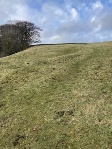
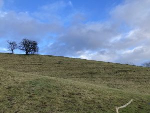
- Thanks to Alan’s connection with Fullwood Hall[1], we were able to explore one of its fields; it is south facing, rising steeply to meet its northern boundary on Harrison Lane
- Our focus was a local belief that there was once a ‘tunnel’ between Bennet Grange and Fullwood Hall:
- Chapter 20 of Fullwood Hall: The First 600 Years[2] provides a thorough exploration of the tunnel story
- Clarke & Wilson (1987)[3] discuss Sheffield’s ‘Subterreanea’ (pp.22 -32). They suggest that a perceived connection between two points, (such as Fullwood Hall and Bennett Grange), can develop into a belief around a physical connection such as a passage or tunnel in local lore; they add that drains, sewers, mines and culverts may also feed into local tunnel lore
- Frank Brindley, a Sheffield news photographer, wrote newspaper articles about Sheffield’s ‘Tunnel Mystery’ in the 1930s, including the ‘underground passage’ between Fullwood Hall and Bennett Grange
- Hall (1974, p.18)[4], also refers to ‘a secret passage’ between the two houses
- There is also a possible connection with priests’ escape tunnels dating from the Elizabethan era, of which there is reportedly evidence in the city centre; Hostombe and Crutch (2023, pp.16-17) discuss this in relation to Priest Hill across the valley
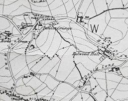
- We were also informed by a Lidar map and by a Friends of the Porter Valley publication (2004)[5]; the following features identified in their Catalogue were of particular interest:
- ‘Underground culvert’ in Bennett Grange grounds
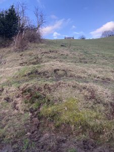
- ‘Possible lynchet’: a ‘short, well-defined bank’
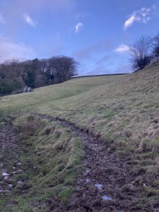
- Traces of possible hollow-way running E-W near the top of the field
- Lynchet: ‘well-defined’, running N-S down the field
- We began in the timber room, under which was a cellar identified as the place where the tunnel allegedly began; differences in flooring materials were noted
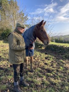
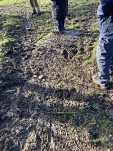
- On reaching the field, we were joined by four curious horses who followed us for the first part of our investigation
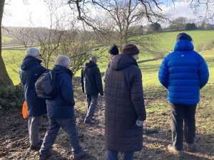
- Various features were noticed:
- those listed above by FoPV (2004)
- a paved pathway which is now almost obscured by earth and turf
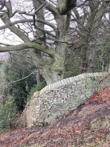
- boundaries: e.g. curved Bennett Grange east boundary drystone wall which may date from 18th century
- waterways & intriguing humps & a rusted metal plate in the wall of Bennett Grange
- terracing which took the form of parallel tracks on the north side of the steep bank; these were later identified as most likely to be “terracettes” – a form of soil creep that gets trodden down by animals to create narrow ridges
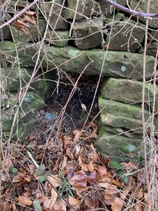
- a sheep-through or sheep creep: ‘purpose-built rectangular holes set in walls to allow access by sheep…typically capped by a long stone lintel.’ [6]
[1] Hostombe, S. & Crutch, A. (2023). Fullwood Hall – The First 600 Years. Northend.
[2] Ibid.
[3] Clarke, D. and Wilson, R. (1987). Strange Sheffield: Legends, Folklore and Mysteries of Hallamshire. Association for the Scientific Study of Anomalous Phenomena.
[4] Hall, M. (1974). More About Mayfield Valley and Old Fulwood. J. W. Northend Ltd.
[5] Friends of the Porter Valley (2004). Porter Valley Landscape History and Archaeology; Final Report. Ardron Unified Landscape Assessments.
[6] Ibid.